
Trek Information
------------------------------
Trek Name: Dzongri-Goecha La
Location: West Sikkim
Nearest Base City/Village: Yaksom
River: Rathang Chu, Prek Chu
Peaks Visible: Kanchenjunga, Pandim, Kabru range, Kumvakarna, Simvo, Kokthang, Kang, Narsing, Jupono, Tenzing, Rathong, Goecha
Glaciers: Goecha, Kabru, Onglakthang, Talung
Itinerary
------------------------------
Day 1 - Start from Kolkata
Day 2 - Shiliguri -> Jorethang -> Yaksom
Day 3 - Yaksom
Day 4 - Yaksom -> Sachen -> Bakhim -> Tsoka
Day 5 - Tsoka -> Pethang -> Dzongri
Day 6 - Dzongri
Day 7 - Dzongri -> Kokchurang -> Thangsing
Day 8 - Thangsing -> Lamuney
Day 9 - Lamuney -> Samiti -> Zemathang -> Goecha La view point -> Zemathang -> Samiti -> Lamuney -> Thangsing -> Kokchurang
Day 10 - Kokchurang -> Pethang -> Tsoka -> Bakhim
Day 11 - Bakhim -> Sachen -> Yaksom
Day 12 - Yaksom -> Jorethang -> Shiliguri
Day 13 - Reach in Kolkata
Our Team
------------------------------

Team Members
------------------------------
Himadri Bhattacharya
Arnab Banerjee

Saugata Acherjee

Susanta Bose
Sanjay Mitra
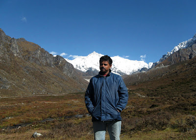
Arindam Dhar

Raja Majumder

Sampa Dasgupta

Sadidul Haque (Palash)

Anish Banerjee

Supratim Roy (Me)

Ration List
------------------------------

Chaal - 20 Kg, Daal - 6 Kg, Potato - 8 Kg, Spinach - 6 Kg, Squash - 4 Kg, Nutrela - 1 Kg, Papad - 1 Kg, Suji - 2.5 Kg, Pasta/Macaroni - 5 Kg, Tomato Sauce - 2 Kg, Chattu - 5 Kg, Muri - 4 Kg, Biscuits - 20 Pkt, Tea - 500 Gm, Milk Powder - 1 Kg, Sugar - 2 Kg, Salt - 1 Pkt, Butter - 1.5 Kg, Mustered Oil - 1.5 Ltr, Chhola - 1.5 Kg, Badam - 1.5 Kg, Salted Badam - 26 Pkt, Salted Chhola - 26 Pkt, Khejur - 26 Pkt, Eclairs - 26 Pkt, Spices - Noodles Masala / Sabji Masala / Turmeric Powder / Black Paper Powder / Chilli etc., Vegetables - Cabbage / Beans etc., Fuel - Kerosene 25 Ltr.
Supporting Team
------------------------------
Guide - J B Gurung (Rs. 400/- per day)
Contact Number - Resi: (035) 9524 1283
Porter - Balkumar (Rs. 200/- per day)
Yakman - Kessy (Rs. 800/- per day for 4 Yaks)
Pictures
------------------------------
In the 5th Oct. morning near Kishangunge, a tire of our bus was malfunctioning, so the bus stopped to repair i. Guys didn't wait within the bus and started venturing around the area.

The Teesta river on way to Jorethang from Shiliguri.

Final packing is going on as next day we will start the trek.

We stayed in hotel "Dzongrila". Our team at dinner table in the hotel .

The one and only team manager (designation provided by us though), Himadri Da.

Sadly we can't start in the next day as no yak is available in the village. Our guide told us that he can arrange for the porters and yaks on 7th. So we decided to visit the nearby places of Yaksom throughout the day and will complete the Police Thana procedures, remained marketing etc. in the evening.

So we started strolling around in several groups.
Some views from Yaksom market place.

Beautiful flower seen near Yaksom High School.

Flower in the garden of a local Monastery.

Local Monastery of Yaksom.

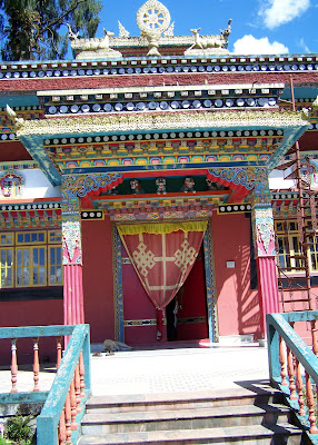

The trail towards the oldest Monastery of Sikkim - the Dubdi Monastery.
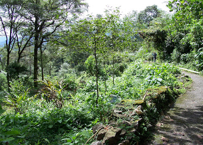


Here all peoples got bunch of leeches all over their bodies.

A strange looking larva.

Dubdi Monastery, the oldest one of Sikkim.

Took some group pictures here.


Sunrise on Kabru, as seen from hotel roof.


The first hanging bridge over Poha Khola. There are four bridges at a distance of 45-50 minutes.


Sampa Di crossing the first bridge.
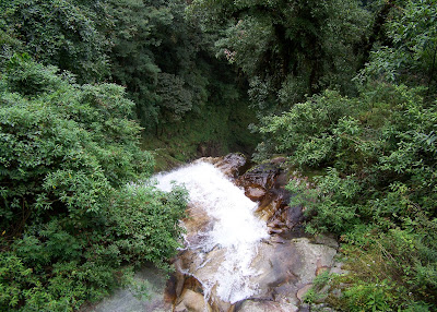

Second and the most risky bridge over Mon Khola.


After every bridge, except the third one, there are these type of shelters for resting.


Raja and Arindam on Third Bridge over Suisa Khola

Arnab Da went down to the river below the third bridge. The rocky surface was very risky as it was covered by thin moss. Arnab Da slipped here and could have meet serious accident, God saved him and us also.

A little insect on the pillers of the third bridge.

Fourth and the longest one over the Prek Chu. We encountered a monster descend before this bridge and after this bridge we found very steep trail upto Tsoka, not a single inch of descending or flat trail. There are lots of shortcuts upto Tsoka, but be very careful when choosing them, some can end with a mess.

Beautiful Prek Chu.

Anish, the boy who made our life terrible with his loud voice during the trip, crossing the fourth bridge.

Sanjay Da, Me and Arindam on fourth bridge.
It was raining continiously after crossing the fourth bridge. We were using plastic sheets to cover us, walking in the dark after Bakhim, holding torch in one hand, whistling regularly to indicate the other members. At last, starting at 8:15 from Yaksom, when we reached Tsoka at around 6:15 it was completely dark. This picture was taken in the next day morning.

Cattle at Tsoka.

Tsoka village as seen from the trail towards Phethang.

Arindam, the most careless person about his clothing, on the way to Phethang.
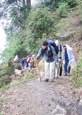
Another long day walk to reach Dzongri.

Palash, the most technical cameraman in our team, going to take some snaps.

Raja and Sougata Da, slow but very steady.

We crossed three ridges of this type before Dzongri, this is the last one.
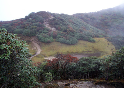
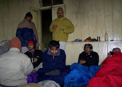
Starting at around 8:30 AM from Tsoka, we reached at Dzongri at 5:00 PM. Our team at Dzongri trekkers hut, though tired but couldn't resist themselves to share the on way experiences and events.
Sampa di, very quick on mountain trails. I just amazed with her speed.


Our rest day at Dzongri. But we started venturing out the nearby areas.


The strange fruit, looking very cute and colorful but actually this is very poisonus.


Some more group photos. Me in the orange-black jacket.


Drying our tents which were got wet at Tsoka.

Next day morning, Pandim from Dzongri top, just before sunrise.

The whole Kanchenjunga range.

Dragon cloud formation over Singalila ridge, the whole ridge was covered with fresh snow.

First sun rays on Kanchenjunga.


Kabru North, Kabru South, Kabru Dome - all are getting fire slowly.

Rathong peak.

Now Kanchenjunga is on fire.

Kabru peaks also competing with each other.


Kokthang peak.

Kang peak.


This face of Pandim never gets sunrise lights but gets the sunset light beautifully.


The whole Singalila range got sunrays.

Arindam in front, Sanjay Da, Me and Sampa Di on Dzongri Top.


Distant view of Narsing.

Tenzing peak.

Every day morning, Dzongri Top is a crowded place.


Another group photo at Dzongri Top.

Kanchenjunga looking very beautiful under full sun light.

Rathong peak, the origin of the Rathong glacier from which Rathong Chu river originated.

Me and Anish, good light effects, Singalila range in the background.
Slopes of Dzongri Top, covered with fresh snow, was looking fantastic.


Trying to catch the sun, is it possible??

I have set this one as my desktop wallpaper.

The Black Kabur in front of the Kabru range.


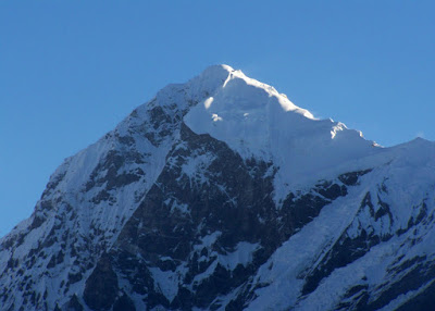
A small bugiyal like place on way to Thangsing from Dzongri.


Trying to take some creative snaps.

Pandim as seen on the way to Thangsing.

Don't create any confusions, this is not an ice cream.

There is another monster descend before Kokchurang. Arindam standing near the Kokchurang trekkers hut.


There are two wooden bridge to cross the Prek Chu river at Kokchurang. Now notice, before the fourth bridge we were on the true left bank of Prek Chu, by crossing the fourth bridge we reached on the true right bank of Prek Chu. Now at Kokchurang, we will again cross it to reach on the true left bank.

The wooden bridge over Prek Chu at Kokchurang.


At last we reached Thangsing at around 4:15 PM starting 9:15 AM from Dzongri.
Me and Arindam pitched our tents as quickly as possible.
Pandim was looking beautiful from here.


Next day morning, Pandim was looking very calm and quiet.

Mount Tenzing as seen from Thangsing.

The true left side wall of east face of Kanchenjunga


Next day morning we took some photos in leisure as our guide said us that we can leave Thangsing a little late.
Himadri Da was so delightful seeing the vast valley in the morning.

Our breakfast at Thangsing, with Suji ka Halwah.
Me eating in a Kadhai getting no other utensil.

Palash, Me and Arindam from left to right.

Our peoples on way to Lamuney from Thangsing, comparatively short and easier trail.
Palash coming through the trail to Lamuney.

This is actually an Yak seen on Lamuney trail, the transporter ones are Dzopky.
Arindam and Susanta Da collecting water on way.
Lamuney camping ground, very windy.
Pandim from Lamuney.

Proceeding towards Zemathang from Lamuney, just a few minutes more.
Taking some rest at Zemathang.

Kanchenjunga from Goecha La view point.

Kabru east face.

Kanchenjunga and Goecha peak.

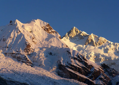


Jupono, this face does not get sun light.


Ice fall comming down from Goecha peak.


Mount Simvo on the right.

Trying some photo session.


We spend some time here.

We spend some time here.

Destination at last, Goecha La - the pass.
Came back to Zemathang from Goecha La view point.
Jupono from Zemathang.

Taking rest at Zemathang.

A little glacial lake.

The junction of two Kabru glaciers, you can see the lateral moraine ridges.
The Prek Chu valley as seen from Zemathang.


The whole Kabru range from Zemathang.
The downwards path from Zemathang is a bit tricky.


Sungmoteng Tso - The Samiti Lake.

The back face of Pandim from near Samiti Lake.

Taking rest before Samiti Lake.

Showing some ice layer formation on lake.
With this picture we can easily demand that Samiti is a Pangong size lake, though it is not.

The abandoned trekkers hut of Samiti.


Returning back to Lamuney.

Lamuney is now visible from over the last ridge.
Proceeding towards Thandsing from Lamuney, our today's destination is Kokchurang.


Onglakthang Glacier.

We got back to Kokchurang at around 4:00 PM.
Moon rise from Kokchurang.


Pandim and Mt. Tenzing are still visible from Kokchurang Trekkers Hut.

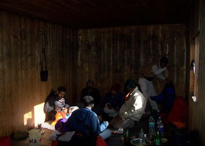
Trail from Kokchurang to Phethang lies between deep forest.


We found this Kokchurang to Phethang trail little bit uneasy.
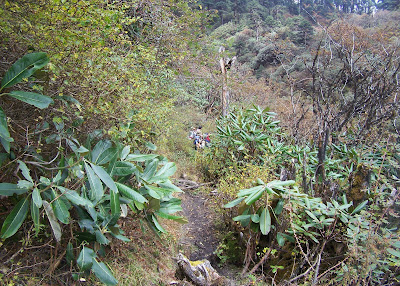

We departed from Kokchurang at 8:30 AM and reached Phethang at around 2:30 PM.


We took another odd 1 hour to reach Tsoka, but our today's destination is Bakhim. After everybody reached here, we all took a cup of hot tea and 1/2 bowl of Yai-Yai.

We reached Bakhim within 20-30 minutes and booked the forest department trekkers hut.

Bakhim is a very picturseque place.


Our dinner at Bakhim with khichdi, Sanjay Da trying to extract some butter.


Trail towards Yaksom from Bakhim. Today we again have to cross those four bridges, the fourth one is most beautiful at the starting day of the trek and most pathetic at the ending day of the trek.


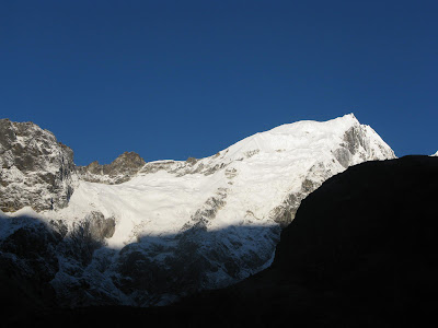




Important Information
------------------------------
** Guide, Porter and Mule/Yak/Dzopkey may ask for 2 extra days charge, confirm that while settling.
** Some young guys in Yaksom market place demand themselves as guide. But we found some team, who faced problems taking these young guys with them. Generally these guys are not registered guide but porter, have lack in communication skills and don't have enough experience to deal the odd cases.
** Check your ration every day. Ration shortage is a common problem in this route. Always show and get checked your ration list and quantity by your guide.
** If you want to stay in Huts and don't have hut permits, ask your guide to arrange, it can be done without prior booking but subject to availability.
** Fees (rates as per Oct '08)
Entry Fee - 150 for first 7 days + 25 for each extra days
Camping Fee - 25 per tent per day
Camera Fee - 10 per camera per day
Guide / Porter/ Yak Driver Fee - 10 per head per day
Yak Fee - 5 per animal per day


